
 |
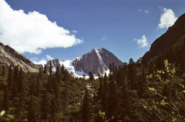
A peak of the Trola Range (Chola Shan) on the eastern side of the Tro La. These Abies squamata forests reach up above 4600m here. Spruce-fir forest tree line reaches this height from Derge to Qamdo, the highest spruce-fir forest tree line in the world. Only junipers (Juniperus thibetica) will climb higher in central Tibet, from where Miehe (2000, see reference in selected publications) reports 4800m. © Daniel Winkler
Derge County, Ganzi TAP, July 1997, 4400m
|
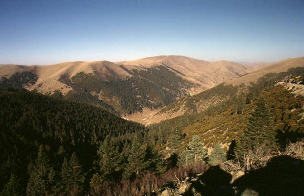 |
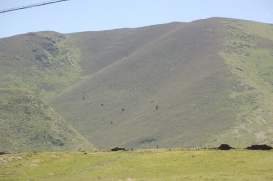
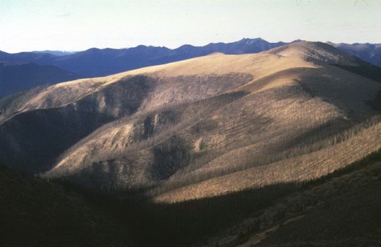
Subalpine forest (Abies squamata, Picea balfouriana, Quercus aquifolioides) grassland mosaic in 4350m in Eastern Litang. Current forest distribution is strongly impacted by human activity. Humans' most powerful agent being fire, livestock and the ax or rather now the chain saw. Around the tree line a lot of the potential forest area has been turned into grazing ground. Every time I travel this road again I notice a new patch or slope burned. Slowly, slowly these forests disappear and are being replaced by pastures. This process is going on since millennia, supporting Tibet's thriving pastoralism. First to go are forests on south-facing slopes. These are most valuable for grazing, especially winter grazing. However, the fact that north-slope forests are hard to burn, since they often retain a snow cover through the winter, is a very important factor as well. © Daniel Winkler
Litang County, Ganzi TAP, February 1999, 4350m
|
Deforestation as a Result of Traditional Landuse
|
In the photo series down below I am showing some examples of loss of forest area to traditional land use practices and remaining relicts backing up the claim. A lengthy discussion can be found in my paper Forest Distribution and the impact of Fire and Pastoralism .
|
|
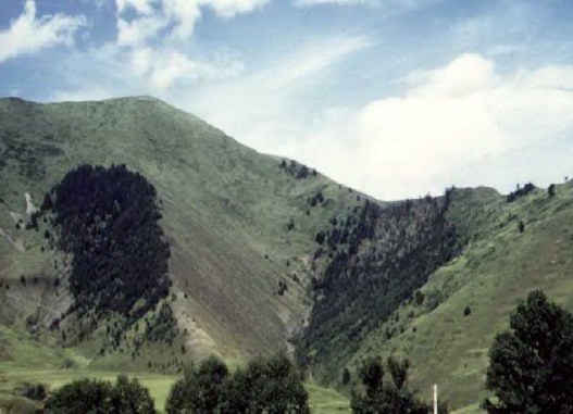 |
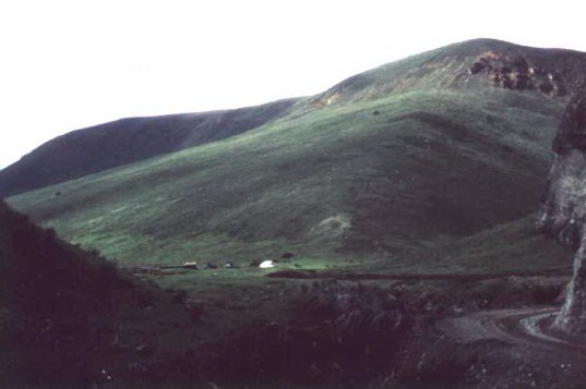
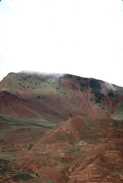
This photo is depicting the contrast between north and south-facing slopes very clearly. South-facing slopes have been turned into pastures. Most north-facing slopes are still covered by trees.
In the past, most scientists and explorers assumed that these patterns were caused by climatic factors such as intense insolation, increased evaporations, prevailing wind directions, snow cover etc. If climatic conditions were the cause, no tree growth would be possible on south slopes. However, a few trees are frequently to be found on south slopes. It was beyond the explorers' imagination to perceive this pattern as a product of steady human impact. Not that these climatic patterns are not important secondary causes, but primarily it is Tibetan herders, who constantly maintain and also improve their economic base, pastureland. © Daniel Winkler, Kangding County, Ganzi TAP, July 1997, 3600m
|
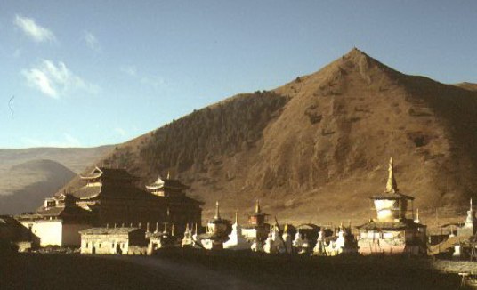 |
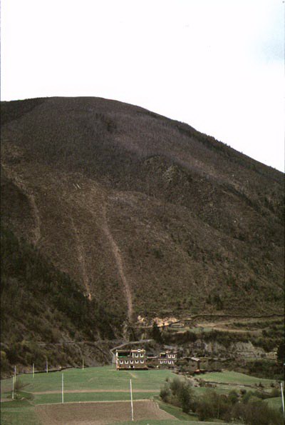
To the east of Lhakang Gompa (Chinese: Tagong) a sacred forest holds onto the slope in an otherwise deforested valley. Relict forests around monasteries are a common feature in the Tibetan cultural area. © Daniel Winkler
Photo: Feb. 1999, Kangding County, Ganzi TAP, W-Sichuan, 3900m.
|
 |
A North-facing slope in Litang near Dahebian, seen from the Litang Highway looking Southeast. A few juniper trees are left indicating that the absence of forests in the highlands of Litang are not caused by climatic reason, but probably by grazing pressure. © Daniel Winkler
Photo: August 2007, 4200m, Dahebian, Eastern Litang County, Ganzi TAP, Sichuan
|
 |
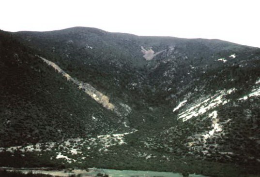
Two last trees clad this slope in an otherwise deforested valley on the northern branch of the Sichuan-Tibet Highway in Tengchen County. Tengchen County is a good example of a potentially forested area which currently has only a few stands left.
© Daniel Winkler
Photo: June 1997, Tengchen/Dengqen County, Qamdo Prefecture, Tibet AR.
|
 |
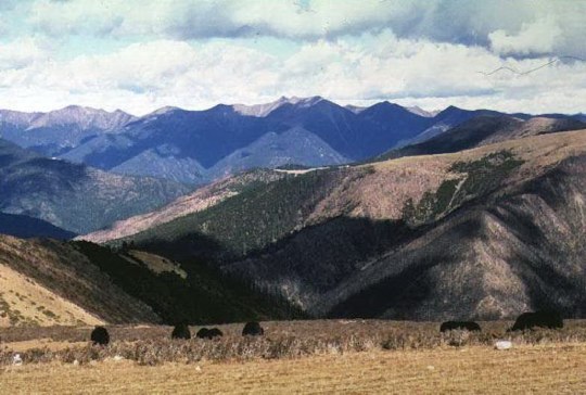
An open juniper forest covers the middle slope in the Zhorong Tsangpo Valley between Trulda and Drigung Til in Meldrogungar County, Central Tibet AR. This forest is unique since the valley is otherwise completely deforested. Only this forest and a few other lonesome stands remain. The fact that these trees are still growing supports the hypothesis that the absence of forests is not due to ecological conditions but human impact. © Daniel Winkler, Photo: June 20, 1997, 3980m, just before sunset.
|
 |
In foreground Yaks are grazing betweenRhododendron - shrub, which is kept short by repeated goat browsing.
In the center the subalpine north-slope fir-spruce forests (Abies squamata-Picea balfouriana) and the secondary south-slope oak forest (Quercus aquifolioides) burned in spring 2000.
© Daniel Winkler , April 2000, 4400m, NE-Litang, Ganzi Tibetan Autonomous Prefecture, West Sichuan.
|
 |
This photo is taken a couple kilometers down the road showing the eastern reaches of the same forest fire.
April 2000, 4400m, NE-Litang, Ganzi Tibetan Autonomous Prefecture, West Sichuan.© Daniel Winkler
|
 |
 |
|
© Daniel Winkler , April 2000, 3900m, E- Nyagchuka / Yajiang County, Ganzi Tibetan AP, West Sichuan.
|
In an otherwise nearly completely deforested valley last stands of trees cling to the slope. As the increased density of trees indicates along the upper left slope of the ridge, the erosion of the instable base rock protects these trees by making access harder for men and beats. © Daniel Winkler ). June 28, 1997, 3900m, Tengchen / Dengqen County, Chamdo Prefecture, Tibet AR]
|
|
To see the a forest distribution map for the Tibetan Plateau click the link and select "Forests" on the lower left. However, the forests of the East Himalaya, Indian administrated Arunachal Pradesh, are included in this map and also the layers are misaligned, which moved forests and rivers way to the north.
|
|